Our day in the sunny South Downs
Our technical team recently had the opportunity to carry out a day of 3D laser scanning, undertaking a drone survey, and a measurement survey on a Grade II* Listed, early 1800s windmill located in the beautiful South Downs National Park. We managed to assist the client with a comprehensive survey allowing them to record the current condition and plan and for restoration work.
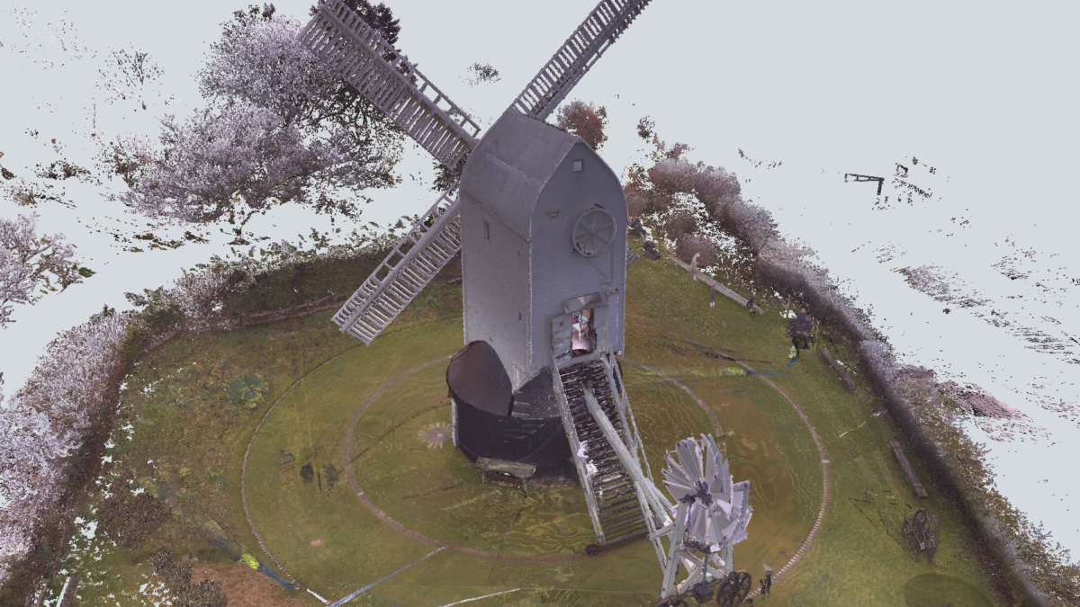
We started with our Trimble X7 laser scanner, rapidly captured millions of points of data to create a highly accurate Point Cloud of the windmill. The scanner was able to capture details such as the intricate shapes of the wooden beams and the unique curvature of the sails. Its millimeter accurate so allows for easy measurement of new components.
Next, we deployed a drone to capture aerial images of the windmill from multiple angles. The drone was equipped with a high-resolution camera that captured images with stunning detail. These images were then used to create an aerial survey of the windmill and the surrounding area, which would prove extremely useful for planning the restoration work.
Finally, we carried out an internal measurement survey of the windmill with our scanner. This involved taking precise measurements of the windmill's dimensions, including the height, width, and depth of each of its structural components.
All of this data was then brought together to create a comprehensive survey of the windmill that would be invaluable to the client. The 3D laser scanning survey provided a highly accurate representation of the windmill's shape and structure, which would allow the restoration team to plan and execute their work with incredible precision. The aerial survey provided a wider perspective, showing how the windmill fits into its surroundings and revealing any potential issues that may need to be addressed. And finally, the measurement survey provided a detailed record of the windmill's physical dimensions, which would be essential for creating accurate architectural plans and determining the materials needed for the restoration.
In all our day was a great success and we were able to deliver all the information to a happy client. The data we gathered will prove invaluable and we hope our tools have gone some way to preserving this amazing heritage asset.